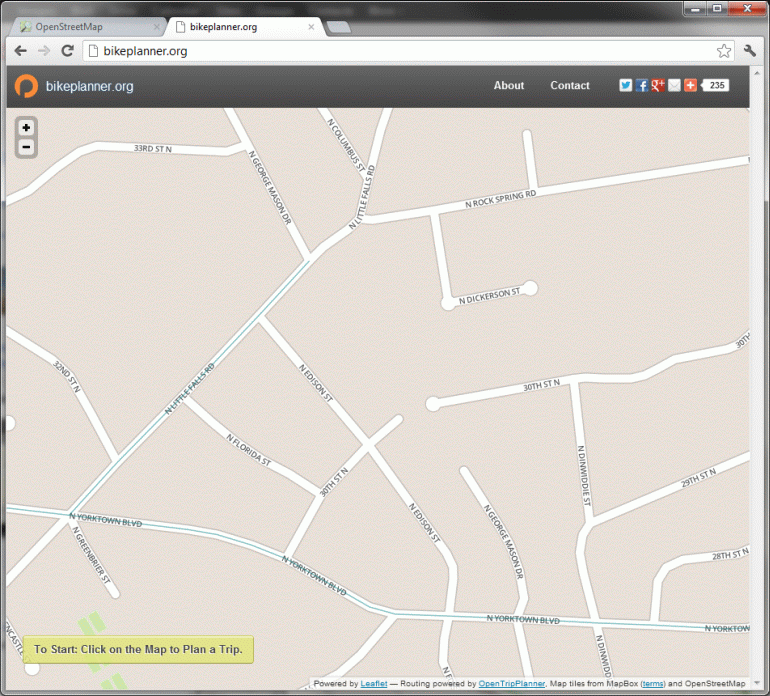
In case you missed the announcement, there's a new tool for planning bike trips: bikeplanner.org
Unlike Google Maps, bikeplanner.org uses map data from OpenStreetMaps which is essentially the Wikipedia of map data. Anyone can go in and add or update information on the map. According to developer OpenPlans, bikeplanner.org refreshes their map data every two weeks.
If bikeplanner.org isn't giving you the results you expect, it is likely due to deficiencies in the underlying map data. Editing OpenStreetMaps data isn't hard (and it can be kind of addictive) here's a tutorial on how to get started.
Before I start, a few caveats: I'm not affiliated with bikeplanner.org, OpenPlans, MobilityLab or really anyone involved with bikeplanner.org. The information I'm presenting has been pieced together from OpenStreetMap tutorials and this link outlining the OpenStreetMap data that OpenTripPlanner (which powers bikeplanner.org) pays attention to.
Adding Bike Lanes to Bikeplanner.org via OpenStreetMaps
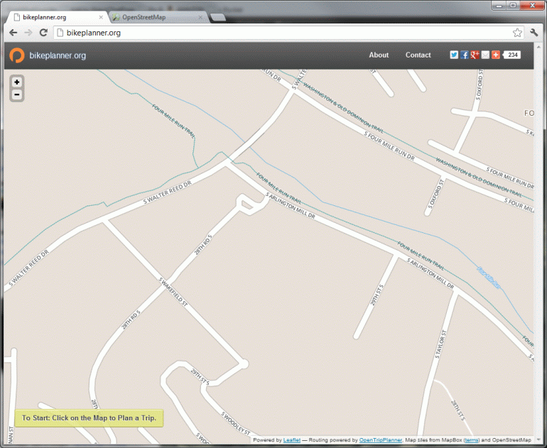
Step 1 - Find a place that needs changing
For this tutorial, I'll add the missing the on-street bike lanes on South Arlington Mill Drive between South Walter Reed Drive and the entrance to the Windgate development. You can see that bikeplanner.org doesn't know about them by the lack of a green line on Arlington Mill Dr.
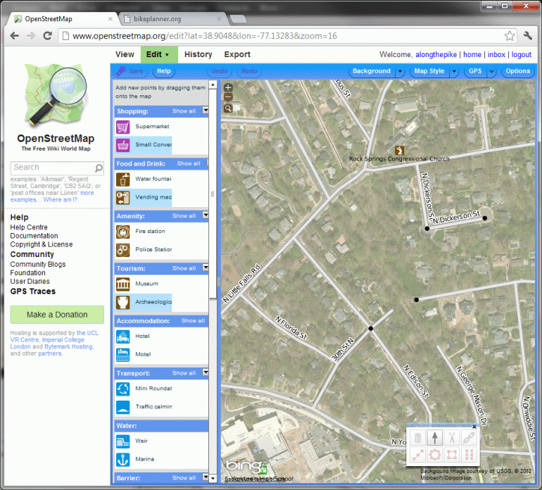
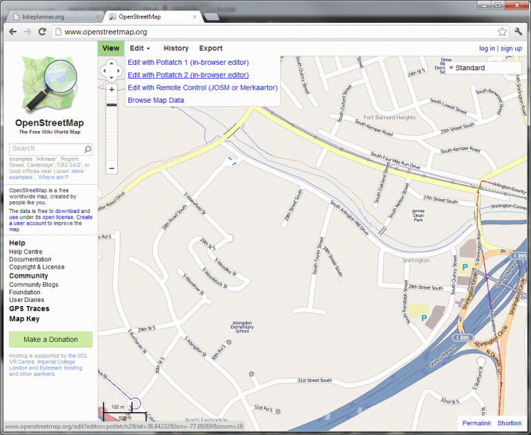
Step 2 - Start the Editor
So we open up OpenStreetMap.org and find the spot in question. Then we go to the edit dropdown and choose an editor - I recommend "Potlatch 2". You'll then have to setup an account - though you can login using many different accounts you may already have like a Google account or Yahoo account.
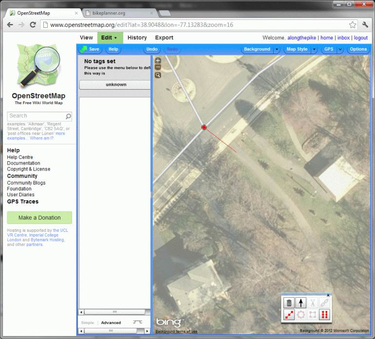
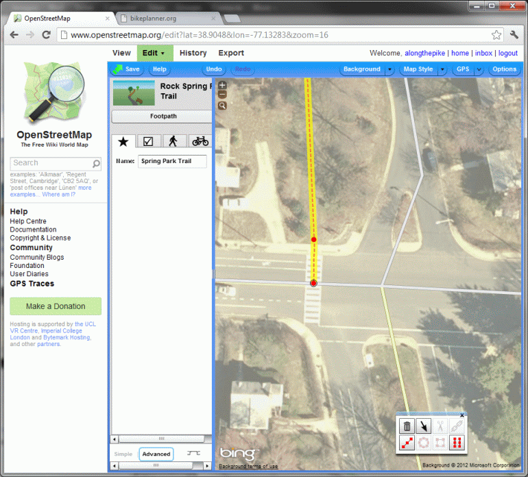
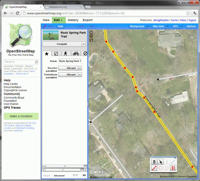
Step 3 - Make Your Changes
So now click on the road, in this case South Arlington Mill Drive and you'll see it highlight.
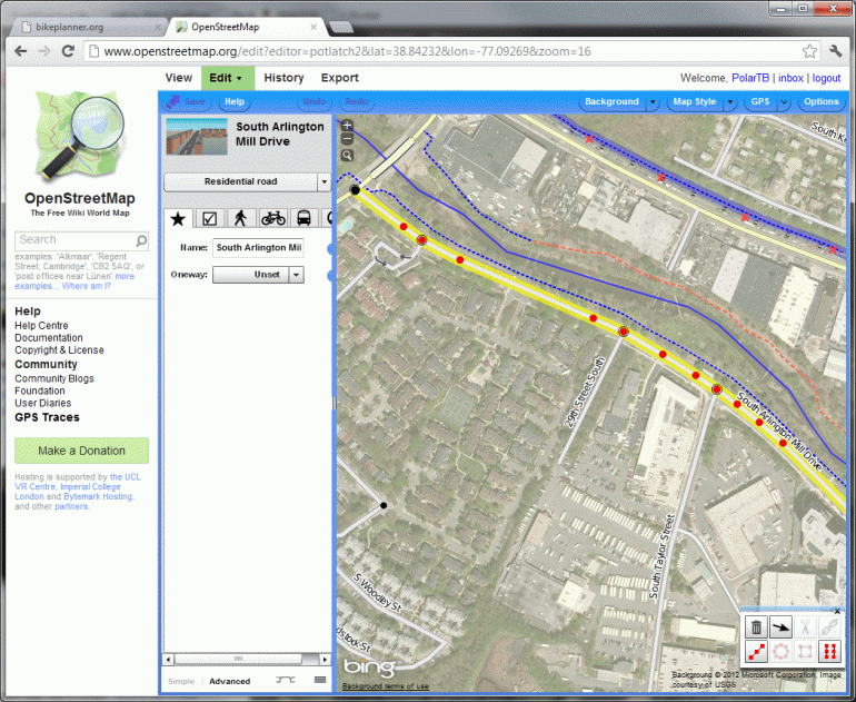
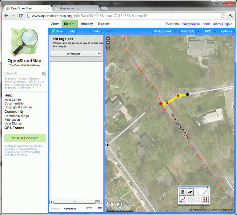
In this case, too much of the road is highlighted. If we set the bike lane options as-is, OpenStreetMaps will think there are bike lanes down the whole length of the road which is sadly not the case. So we need to "split" the road into segments. Often there will already be a point to split on as it will be an existing intersection. In this case, the entrance to the Windgate is not currently added to OpenStreetMaps as a road so we'll need to add the point. To do so, hold down shift and click on the spot on the road where you want to add the point. You'll see a new red dot added.
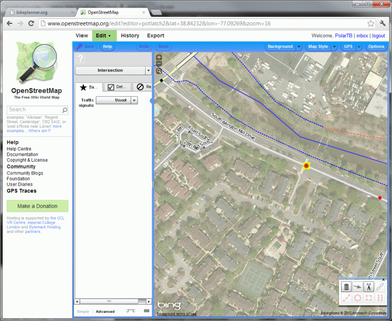
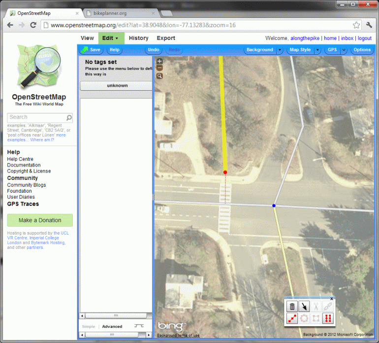
With that dot selected, click the scissors icon in the bottom right to "split" the road at that point. Now when you re-select the road only the part of the on one side of that point will be selected. Depending on what you're doing, you may need to do this at the other end as well.
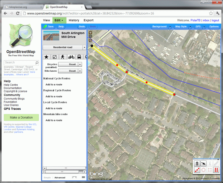
Now with just the segment you desire selected, go to the cycling tab of the road segment and set the options for "Bicycles Permitted" and "bike lanes". In this case, I chose "Designated" for "Bicycles Permitted" option and "On-road Bike Lanes" for the "bike lanes" option. Finally, hit the "Save" button in the top left and describe the sort of changes you're making and you're done editing!

Step 4 - Wait
Within two weeks your update should appear on Bikeplanner.org
Doing More
You can also add trail connections, mark designated bike routes, mark roads that should be avoided by cyclists, mark bike lanes that only appear on one side or the other and many other pieces of data that bikeplanner.org uses. If people find this tutorial useful I'll definitely do one on adding trail connections. If you want to dive in yourself, the most vital link is this one which outlines how OpenTripPlanner uses OpenStreetMaps data for routing purposes. You should also spend some quality time in the rest of the OpenStreetMaps Wiki.

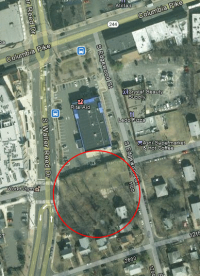 The project consists of 2,960 square feet of retail, 14 residential condo units and 8 townhouses on the empty parcel of land behind the Columbia Pike Rite Aid. The project will begin the construction of the missing segment of 11th St between Walter Reed Drive and Edgewood Street; at the completion of this project, 11th St will be one way eastbound. When and if the Rite Aid building redevelops under the Form Based Code, that project will provide additional land to finish the street resulting in a final 2-way cross section with parking on both side. The building heights vary from 5 stories at the corner of Walter Reed and 11th St down to 3.5 stories as the project approaches the surrounding neighborhood.